Sunday, 29 May 2022

Albury Model Railway Exhibition 2022

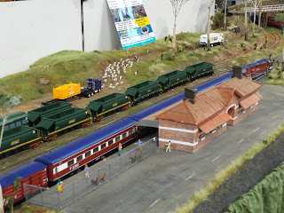
 Murray Railway Modellers - Annual Model Train Show

On Sunday, May 22, I joined Pete and Ben, and car pooled our way from Junee south to Albury.

After a manditory stop for morning tea (at Culcairn), we arrived at the exhibition about 11am.  
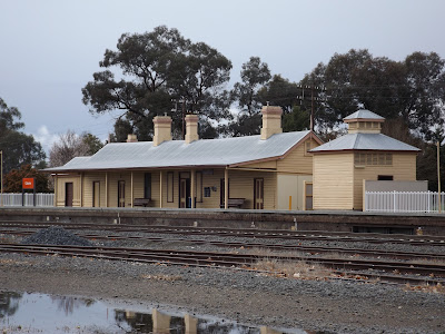

Culcairn station


The Albury Exhibition was back at its normal venue in Lavington, and almost back to normal with eased covid restrictions.  

For a regional show, Albury has an advantage being reasonably close to the Victorian population centers, so there is a high chance of seeing layouts that don't venture further north.  Other advantages are good retail support, close parking, great catering, and a second-hand area.

Being Sunday, I doubted that there would be anything left in the second hand area.  I was pleasantly surprised that I was wrong.  An ANEModels DCC Smart switch servo driver set for $20 was the pick, although I did find a campbell's stock yard kit; both destined for the future layout.  Plus some books.  (The servo driver kit was near complete - had all servos and electronics, only missing the toggles, and instructions - both of which I had). 

Then off to the retailers.  I like to support the retailers that support the hobby.  SDS was a major sponsor, and they had a stand full of temptations.  My mastercard says I spent $360 there.  Other retailer were RW Hobby, Paul's 3D Prints, Road & Rail, The Model Emporium, Byron's Trains, Hayward, Stafford Stamps & collectables, Lyndon's Trains, and Trackrite. 

Inland Rail also had a public information booth at the exhibitioin - and were giving away a few freebies, and pamphlets on the changes occuring for double stacking in the Albury-Illabo section.

Some of the Layouts.


Culcairn in N scale - Mark Jesser has been making this model since 2017, and uses T-Trak standards. All the buildings/bridges are scratch built and  modelled after the real structures in Culcairn. 

Mid Valley by Greg Hughes included a sawmill.  This had some interest for me, as I will need a small sawmill for Tumbarumba


Healesville was a "new" layout for me.  Whilst the prototype line is being restored as a tourist railway, trains running on this layout are both from the past, or current Victorian railways.  Possibly the lack of a backscene is its only shortcoming for taking pictures.  


Somewhere Creek by Stuart Cray was another "new" layout for me.  Started around 7 years ago, it features a lot of scratch built structures, following a freelance Victorian Railway theme.  


Ettamogah by Peter Allen & Graeme Shultz is a sizeable layout, depicting the large former paper mill sidings,  now a Rail Hub Container handling site, besides the Hume Highway 

After about 3 hrs at the exhibition, including a light lunch, Ben, our driver, decided he wanted to do a bit of sight seeing.  

The Tallangatta branch

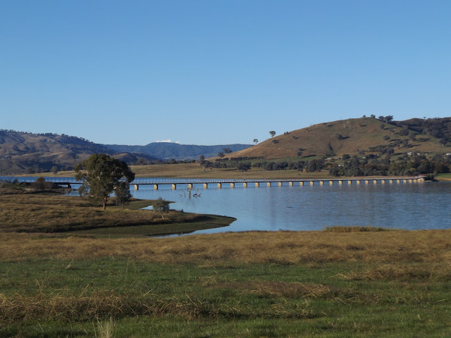
Our first stop was the Hume Weir.  There was once a lot of narrow gauge railway activity to build this dam, but there is little evidence of it now.  Not even a display.  Good to see Hume Dam almost full.

I had not ventured along this branch since 2002, when I returned to Canberra from a karate tournament via Tallangatta, Shelley, and the snowy mountains, to avoid a boring drive up the Hume Highway  In 2002, there was no rail trail.


Ebden station site.  Now a stopping place for the cycletrail

Huon Goods shed


Abandoned Walkers Railcar at Huon.  This relic was left behind by a group that wanted to restore a section of the Tallangatta line as a tourist venture.  I had seen the accumulation of railway vehicles in 2002, but this is the only thing left.  Rather sad to see it stripped and left to the elements.  


I have a brass model of a Walkers Railcar, and Trailer - this one made by Ajin, for ALCO Models (australia) in the 1990s

The long viaduct over the dam water is now a highlight of the rail trail.


Site of the Tallangatta station


Tallangatta Goods Shed.  This end is as built - the other end had been extended at some stage


Some interpretive signs as displayed beside the railtrail. Click on an image to enlarge to read it better.

We got back to Junee around 8pm, after a stop at KFC for tea.  A most enjoyable day.

Until next time....

Saturday, 14 May 2022

Downfall area, and construction camp


Downfall – a railway lost to the bush


The Downfall is a section of railway line between Humula and Rosewood.  It was also once the name of the railway construction camp, that boasted a school, and post office.  Information on the downfall village has been researched by the Tumbarumba Historical Society, and published in a book authored by Ron Frew, called “Recycling Rail”, that I reviewed 2 years ago.  The below picture, and text are taken from this book.

At cut 154, a compressor piped air for the drilling - Dec 1916


The largest construction camp in the area was at Downfall(s) west of Rosewood, where the climb required a large ‘S’ bend where the line crossed the gully 3 times to maintain grades. Some cuttings and fills are 30 metres deep.

To build the cuttings a system called the ‘Chinaman’ was employed. Tunnels were bored into the cutting site, and roof timbers inserted. The rock above was then loosened into the waiting (narrow gauge – my insert) rail wagons beneath.  One man was killed during construction of this section.

The camp, better called a village, included 3 tent shops, one a tent shop run by Edmonson and Co. of Wagga,  two bakeries, a barber, a butcher, post office, a dance hall, and boarding houses.  The ‘streets’ had water taps about every 50 metres. Workers to be paid 8 shillings a day, in cash. Every second Wednesday, the pay cart, a 4 wheel, 2 horse buggy, carrying the paymaster, and the driver came up from Humula. An armed policeman rode alongside.

About 300 men were employed at Downfall, many with families, so there was need of a school, the nearest being Rosewood at 5 miles, and Humula at 12 miles distant.  49 school age children were identified.”

The first school was opened in Jan 1917, and permanent buildings erected by April 1917. However, the work on the railway was suspended 4 months later, and the school closed.  Resumption of work in 1919, resulted in reopening with 20 students, although, by June 1920, work had been completed, and the school closed for the last time.

A section of the Rosewood 1:100000 topographic map shows the abandoned line.  The S bend is close to #74 in the middle of this map.  The topographic map kindly supplied by Scooter. 


What is there now

Last year, I had the good fortune to visit this area with my mate Rod.   We didn’t explore the village site, but did get to the railway alignment  The line runs in state forests, and is only accessible via fire break tracks.   The catastrophic  Dunns Road megabushfire in 2020 spared this area


The last "station" south of Humula before the Downfall Road leaves is Nurla. This originally was a stopping place for the railmotor to collect milk for processing in Wagga

Rod's son poses on the embankment at Nurla

A facsimile nameboard has been erected on the line.  Nice touch

Speed boards on the line south of Nurla, just before turning off the Downfall Road, onto the Scrubby Creek valley.  Seems a bit redundant, but a necessary detail to include when modelling the line


The Downfall road crosses Scrubby creek bridge, but the line continues to the west of the creek, heading southwards into the state forests


After entering the state forest area, the line is well above Scrubby creek.  Enlarge the image to see the line better.


Closest to Humula, we ventured on logging roads to the west and made contact with the railway


3 pictures of the line at the first stop 

Our second excursion off the Downfall road


3 more images at our second stop site.  The Eastern Grey kangaroos were a bonus

It is not possible to get to the S bend from the Downfall road, so fire trails have to be negotiated. It is 4WD only.


Lower level of the S bend.  7 pictures.  The embankment in the last picture is very overgrown, and difficult to photograph showing how deep it is.


Middle level - 4 pictures.  The last one shows the embankment a bit better than the one at the lower level.  At the bottom of the embankment there is a very large pipe culvert.


Upper Level - 5 pictures, the last 2 show the embankment.  There is a certain simularity with all 3 levels.


Heading towards Rosewood, the line exits the state forest area, and crosses the alignment of the Downfall Road.  There used to be an overbridge, but the road authorities filled it in, and there is not not many clues if you are driving along the road that the railway was once there.  It is a blink and you will miss it. (3 pictures)

In 1969, a tour train approaches the Downfall road bridge.


Remains of the concrete "Brakes" post a little bit further on from the Downfall road bridge location.  


The railway line is in extremely good condition, despite the fact that the last official train ran in 1974.  I wish to thank Rod Smith, for his extensive knowlege of the area, and for conducting my tour. 

 The layout

Although I don’t have space on my layout for the full “S” bend, I hope to be able to include 2 cuttings, one embankment, plus the Downfall road bridge.  I hope you have enjoyed reading just a little history.


Until next time  


Last tour train 23/4/72.  3144 leads AB91, and the relief Junee open carriage set 47B heads up the middle level of the downfall S curves.  Picture by Dennis Mitchell.  Compare the image with the pictures recently taken from approximately the same location.

Monday, 18 April 2022

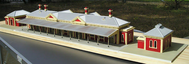
Wagga station - Concrete paving

 Concrete paving - an exercise in using a lot of styrene.


Turning a group of buildings into a ready to install diorama is the subject of this blogpost.

My photo from around 1982, shows the main entrance of the Wagga Wagga station, with all the add-on temporary offices, and rooms on the former verandas.  When I started making my model, I was in 2 minds whether to make it like this, or go with the asthetically pleasing heritage makeover.  I chose the latter.  Note the wide car park.


Creating an illusion of reality ensures that buildings form part of the landscape, and don't sit on top, with a visible "air gap" under the walls.   Way back 20 years, I conducted an experiment on the ACTMRS layout, "!2th Street Yard", where I installed a sidewalk along a sloping street, with a 3mm deep gap between the sidewalk, and the backscene where building flats could be placed.  


12th Street Yard building flats could be assembled with flat bases, and were placed into a gap behind the sidewalk, and not cut to fit the slope of the street. They were made vertical by bolstering the down hill edge of the building flat by a block of wood (also hidden)

From normal viewing angles, you could not see the gap.  The experiment worked.

I have attempted to follow this example with Wagga Wagga station, by cutting slots in the plastic styrene for the same purpose.  from normal viewing angles, you won't see a gap.

Station Platform, and awkwardness.

The main platform was integral to the platform awning, and it scaled 5 mm higher than the base of the walls.  At the same time, the footpath at the main entrance was only 2mm higher than the base of the walls.  This set the scene where the concrete paving had to slope 3mm , or almost one scale foot from the platform to the front footpath.  Fairly subtle, but necessary.  This little fact has complicated the paving task - and added a lot more time to my build.

The paving around the station is a seperate section. It is the same height as the front entrance, and maintains this height in front of the veranda (which is 2mm higher again).  On the side of the station buiding, it rises to match the 5mm platform height.  I used 0.040 thick styrene sheets, and the height is made up with different thickness ribs on the underside


The Gents Toilet building sits in a cutout.  Note the way the edge slopes from 5mm to 2mm. (You may need to click on the image to enlarge this) 

I used multiple pieces of styrene to make the paving.  Yes, that would not be a smooth finish with all the pieces butting up against each other - but it was a way to minimise styrene wastage.  The little cutouts are for the building's decorative blockwork

After around 3 weeks of what I admit was a dull, and tedious process, I was able to spray paint the paving floquil concrete.  Yes, there is a slight variance in the colour of the platform under the station awning - simulating I hope, a different surface texture.  I have also sprayed the roofs of the Gents toilet and museum buildings.


None of the concrete paving is yet secured, as some fine tuning still is needed, and that may be easier on the workbench.  But once glued into position, the slight warping of the paving on the roadside, will be eliminated.


Roadway/ Carpark

Finally, something extra.  Using Floqul Grimy Black, which does not swell the wood fibres, I brush painted the roadway.  Maybe a bit dark, but dust seems to weather it down.  

A trio of Valiants on the newly painted road surface.  Yes, they should be angled parked based on my 1982 picture.  The cars are HO scale Road Ragers, and first impressions that they are too small.  But I know my station is correctly scaled (I measured it), so it is correct.  This picture taken in the gloom of late afternoon, before the rain.  

Until next time, build a model or two.