A Visit to Humula
 |
| An ARHS tour train at Humula before heading towards Tumbarumba |
Humula was the temporary terminus of the branch line from Wagga Wagga to Tumbarumba from 1917 to 1921. It is situated on Umbango Creek . According to Wikipedia, the original name of Humula was American Yards, or American Fields, during the gold rush period, but by 1888, the name Humula was officially adopted by the Post office.
The current (2016 census) population is 124.
 |
| The Humula yard diagram shows the triangle, stocksidings, goods shed, loading dock, and signals. |
The following pictures are from those that I have been sent, or found on the internet. I apologise if I have inadvertantly published - and will take corrective action if notified.
 |
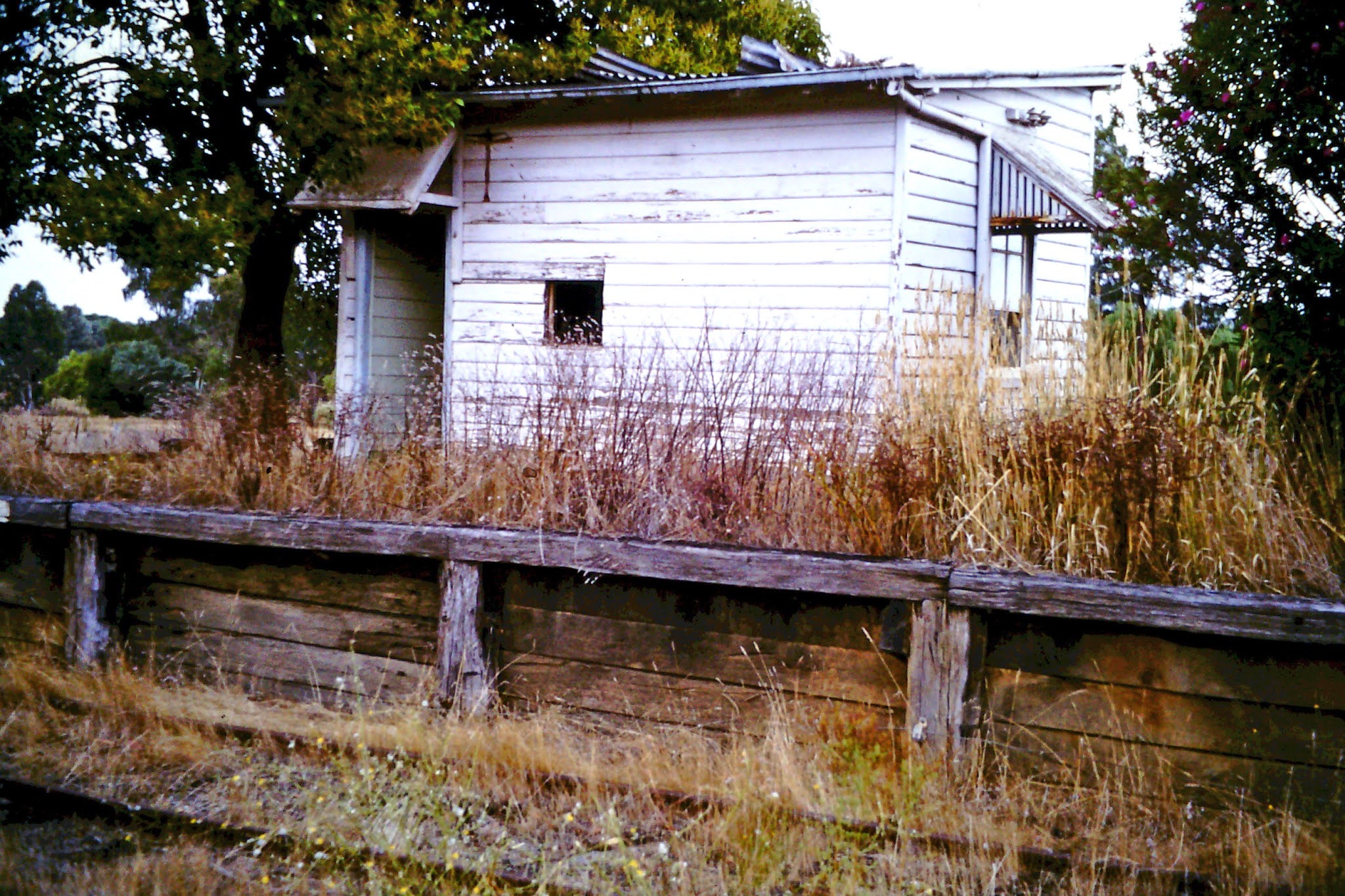
| Humula station in approx 1965. The station neverhad an awning. The signalbox is the next building on the platform. |
 |
| ARHS tour train in the 1960s. I cannot sight the water tank, or goods shed that the signal diagram shows |
 |
| Another ARHS tour. The sawmill is on the hill to the left of this image |
 |
| Final train movement in 1974, was a 48 class, clearing wagons. Note the pair of water columns. I don't know what the "bollard" was besides the 48 class. This image, and the following kindly supplied by Rod Smith. |
 |
| 48 class passes the station. |
My first visit to Humula was early in the early 1980s, and there was not much then.
 |
| Looking south towards the station. My location was the "Humula 8 mile road" level crossing. Lattice signal mast still in position. B&W as the colour tints in the slide were bad |
 |
| Water Column, and lever frame at the south end of the platform. Of interest to me is that the lever frame was not located in the signal box. Patterson's curse was everywhere |
 |
| Sawmill site on the hillside to the SW of the station was still in operation judging by the smoke, during my 1980s visit. My slide conversion colour balance will need some work. |
 |
| Signalbox on platform. The station building had been removed a few years earlier. |
Last weekend, I had an opportunity to revisit Humula, and see what could be found after 46 years of no trains. The results are below
 |
| Lineside telegraph pole still had wires attached. This pole is just south of Humula, as seen from the Downfall road |
 |
| Same location as the pole, a large concrete culvert under the line. At some stage, a farmer had fitted a corrugated iron barrier, in an attempt to stop wandering stock. |
 |
| A smaller culvert. |
 |
| Perched on a hill, overlooking the station was a NSWGR water tank. I had not expected this tank here, as the one diagram I had found showed a tank at the southern end of the station. Although I was never able to verify that from photographs of tour trains taking water. Unsure if the tank is being used now. There is no evidence of any path or ground disturbance leading to the ladder. And it is the first time I have seen a cage on a NSW water tank ladder. |
 |
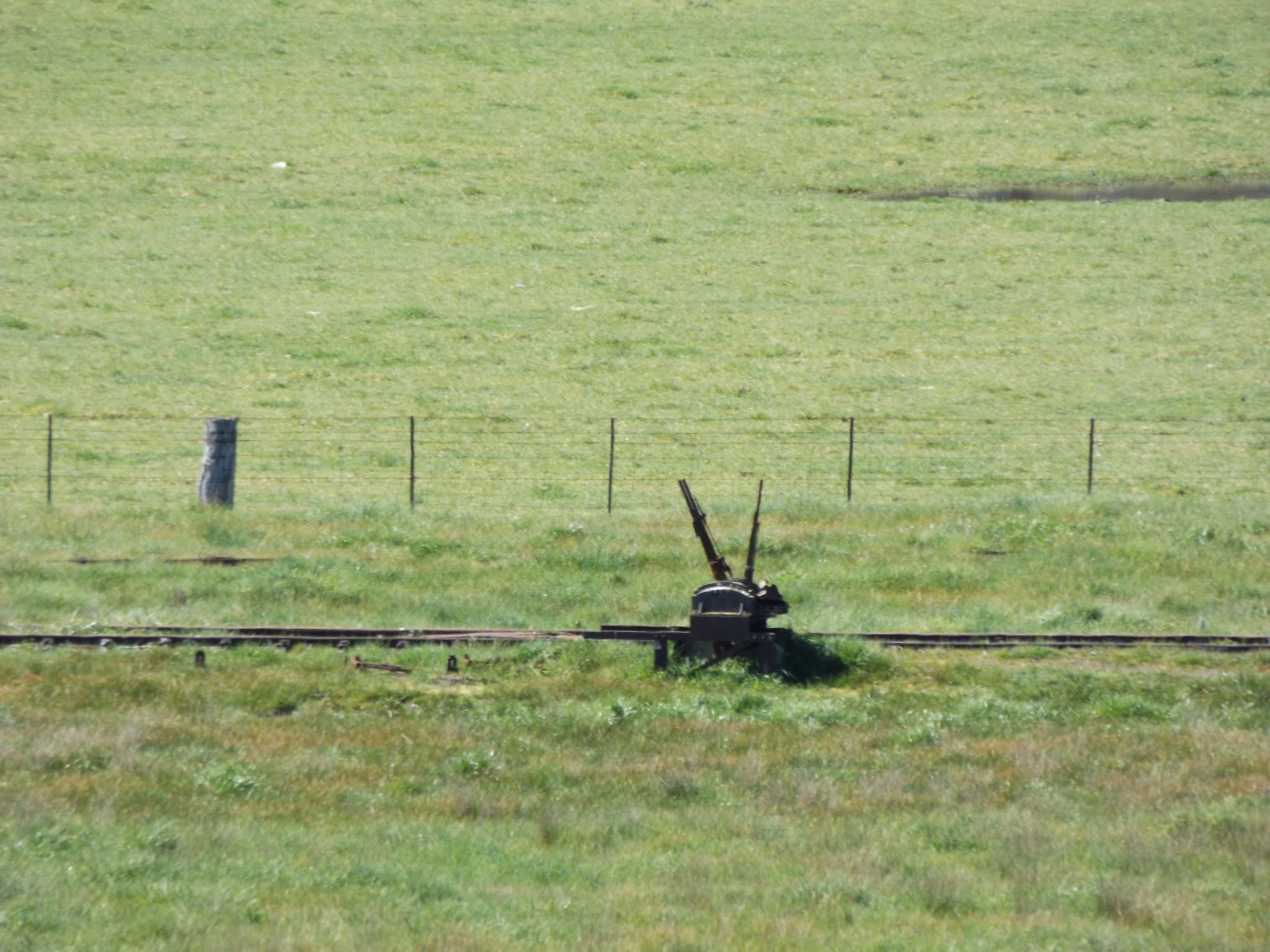
| Lever frame for southern end of main yard |
 |
| Lever Frame for northern end of stock siding |
 |
| Water tank on the hill to the south west of the station. I am not sure if this is the original location of the tank, or if it was moved from the station yard area at some stage. In any case, it has a commanding view. |
 |
| Lattice signal mast at southern end of yard. Although the signal is not in the location I expected. |
 |
| Stock yard loading, and signal to the south but still beside the stock siding. The signal diagram does not place the signal at the southern side of the stockyards, it places it on the northern side. This area was also where the southern side of the triangle would have reattached to the line. This picture taken from the Downfall Road |
 |
| Close-up of the what remains of the stock loading ramps. |
 |
| Umbango Creek was running. This creek flows on the eastern side of the railway for a considerable distance |
 |
| Humula 8 mile road bridge across Umbango Creek in Humula Village |
 |
| Railway embankment - line heading towards Wagga. Picture taken from close to the picture of the road bridge |
 |
| Abandoned Cottage close to the railway precinct roadway. Unsure if the cottage had a railway connection |
 |
| Another view of the cottage |
 |
| Access road, that was once the road into the station. There is not a lot left to indicate there was once a platform on the right. |
 |
| Lever frame at the northern end of the station yard |
 |
| Another view of that lever frame, and structures in the background on what was once the sawmill site |
 |
| Similar angle to my earlier B&W picture showing horses. Taken from close to the former Humula 8 mile road level crossing. There has been much erosion in the embankment below the line, although it might have been once a stock grid. The lever frame pictured earlier can just be made out below the tree. Hasn't the tree grown compared to the earlier picture |
 |
| Could this be part of the original sawmill? It is in the right location |
 |
| Another view of the enbankment north of the station |
I found it amazing that so much of the line infrastructure could still be seen after 46 years with no trains. Certainly, these images will definitely help when it comes to making a model.
Until next time.


Hi Rob, this link may be of use to you - it mentions an abandoned farmhouse near Humula, so that could answer your question above - https://railpage.com.au/f-p2053069.htm
ReplyDeleteThanks again Robert for your information, and link. No, not the same structure. BTW, I now have your recent recommendation, the "Recycling Rail" book by Ron Frew, which I am currently reading. Lots of great information, and answers a question I posed in the previous blog post on Docker street sidings - the owner of the sawmill at Tumbarumba is Hardys - and a picture of timber being carted by rail. I will review in a future blog-post.
ReplyDeleteSome more information has come to hand. The water tank was purchased by Southern Riverina County council, in Jan 1964, and moved to the hill to provide/supplement the water supply for Humula. Although why the railways would then spend money to reconnect the water columns for the very few steam locos after 1964 remains a mystery.
ReplyDeleteAnd the cottage, according to information provided by Rod Smith, was owned by Les Sykes - who also owned the land that the triangle was on. So unfortunately, is is not directly connected to the railway.
Hello Rob did we meet at the Humula Washington Hotel Auction?
ReplyDeleteI wasn't there, so no. But thank you for the heads up. Just looked up the real-estate pages for 9 Mate Street Humula, and it looks to be a wonderful structure. The 3D interactive view is an eye opener - and full of details that could be ideas for modelling the interior. And the floor plan is good too. The area of have assigned on my trackplan though doesn't have space for the village, but if I did, this would be gold. Thanks for your interest.
Delete