Downfall
– a railway lost to the bush
The
Downfall is a section of railway line between Humula and Rosewood. It was also once the name of the railway
construction camp, that boasted a school, and post office. Information on the downfall village has been
researched by the Tumbarumba Historical Society, and published in a book authored
by Ron Frew, called “Recycling Rail”, that I reviewed 2 years ago. The below picture, and text are taken from
this book.
 |
| At cut 154, a compressor piped air for the drilling - Dec 1916 |
“The
largest construction camp in the area was at Downfall(s) west of Rosewood,
where the climb required a large ‘S’ bend where the line crossed the gully 3
times to maintain grades. Some cuttings and fills are 30 metres deep.
To build
the cuttings a system called the ‘Chinaman’ was employed. Tunnels were bored
into the cutting site, and roof timbers inserted. The rock above was then
loosened into the waiting (narrow gauge – my insert) rail wagons beneath. One man was killed during construction of this
section.
The
camp, better called a village, included 3 tent shops, one a tent shop run by
Edmonson and Co. of Wagga, two bakeries,
a barber, a butcher, post office, a dance hall, and boarding houses. The ‘streets’ had water taps about every 50
metres. Workers to be paid 8 shillings a day, in cash. Every second Wednesday,
the pay cart, a 4 wheel, 2 horse buggy, carrying the paymaster, and the driver
came up from Humula. An armed policeman rode alongside.
About
300 men were employed at Downfall, many with families, so there was need of a
school, the nearest being Rosewood at 5 miles, and Humula at 12 miles
distant. 49 school age children were
identified.”
The first
school was opened in Jan 1917, and permanent buildings erected by April 1917.
However, the work on the railway was suspended 4 months later, and the school
closed. Resumption of work in 1919,
resulted in reopening with 20 students, although, by June 1920, work had been
completed, and the school closed for the last time.
 |
| A section of the Rosewood 1:100000 topographic map shows the abandoned line. The S bend is close to #74 in the middle of this map. The topographic map kindly supplied by Scooter. |
What is
there now
Last year,
I had the good fortune to visit this area with my mate Rod. We didn’t explore the village site, but did
get to the railway alignment The line
runs in state forests, and is only accessible via fire break tracks. The catastrophic Dunns Road megabushfire in 2020 spared this
area
 |
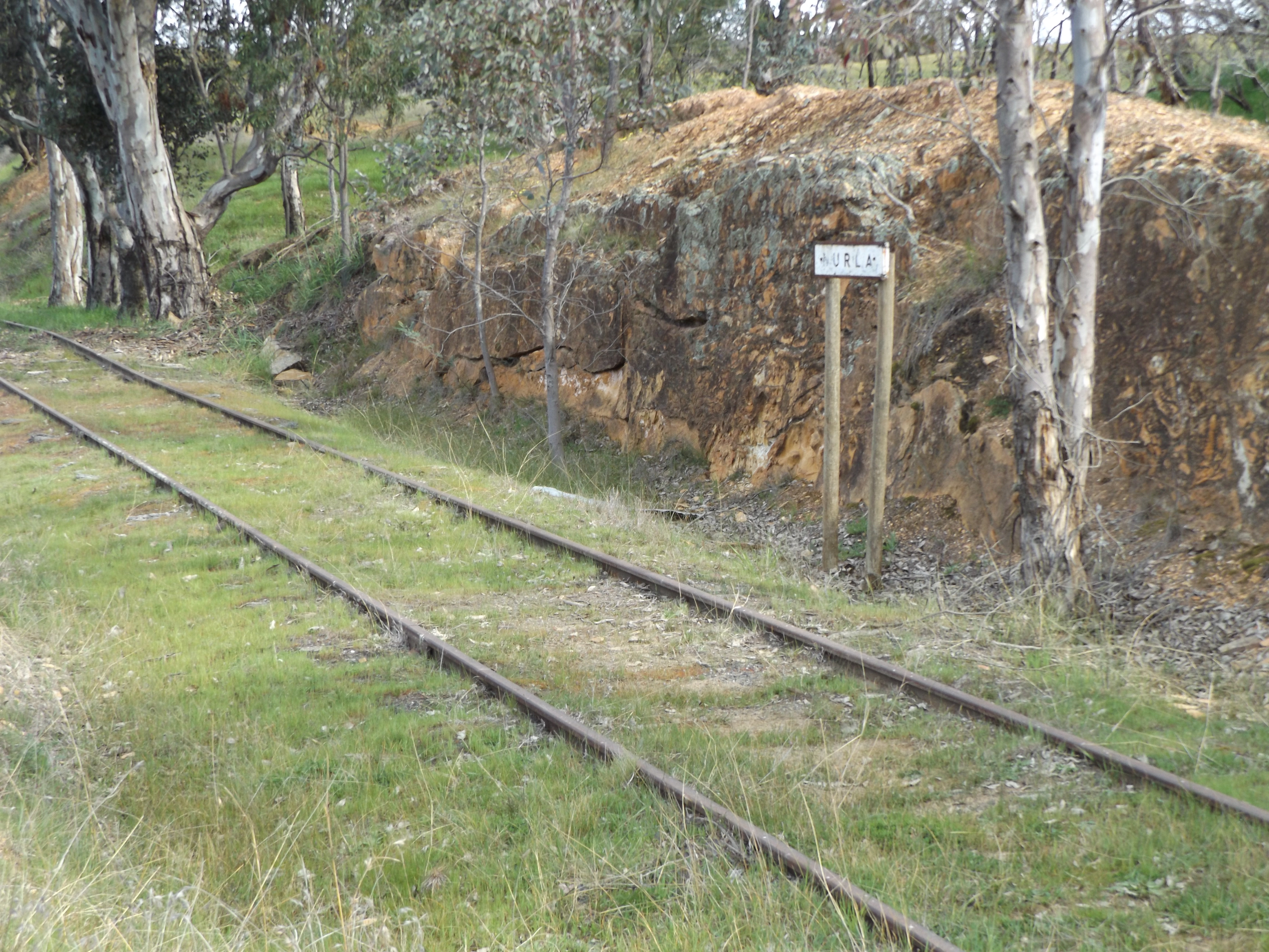
| The last "station" south of Humula before the Downfall Road leaves is Nurla. This originally was a stopping place for the railmotor to collect milk for processing in Wagga |
 |
| Rod's son poses on the embankment at Nurla |
 |
| A facsimile nameboard has been erected on the line. Nice touch |
 |
| Speed boards on the line south of Nurla, just before turning off the Downfall Road, onto the Scrubby Creek valley. Seems a bit redundant, but a necessary detail to include when modelling the line |
 |
The Downfall road crosses Scrubby creek bridge, but the line continues to the west of the creek, heading southwards into the state forests
|
 |
| After entering the state forest area, the line is well above Scrubby creek. Enlarge the image to see the line better. |
 |
| Closest to Humula, we ventured on logging roads to the west and made contact with the railway |
.JPG) |
| 3 pictures of the line at the first stop |
 |
Our second excursion off the Downfall road
|
.JPG) |
| 3 more images at our second stop site. The Eastern Grey kangaroos were a bonus |
 |
| It is not possible to get to the S bend from the Downfall road, so fire trails have to be negotiated. It is 4WD only. |
 |
| Lower level of the S bend. 7 pictures. The embankment in the last picture is very overgrown, and difficult to photograph showing how deep it is. |
 |
Middle level - 4 pictures. The last one shows the embankment a bit better than the one at the lower level. At the bottom of the embankment there is a very large pipe culvert. |
 |
| Upper Level - 5 pictures, the last 2 show the embankment. There is a certain simularity with all 3 levels. |
.JPG) |
| Heading towards Rosewood, the line exits the state forest area, and crosses the alignment of the Downfall Road. There used to be an overbridge, but the road authorities filled it in, and there is not not many clues if you are driving along the road that the railway was once there. It is a blink and you will miss it. (3 pictures) |
 |
| In 1969, a tour train approaches the Downfall road bridge. |
 |
| Remains of the concrete "Brakes" post a little bit further on from the Downfall road bridge location. |
The railway
line is in extremely good condition, despite the fact that the last official
train ran in 1974. I wish to thank Rod Smith, for his extensive knowlege of the area, and for conducting my tour.
The layout
Although I
don’t have space on my layout for the full “S” bend, I hope to be able to
include 2 cuttings, one embankment, plus the Downfall road bridge. I hope you have enjoyed reading just a little
history.
Until next time
%20Dennis%20Mitchell.png) |
| Last tour train 23/4/72. 3144 leads AB91, and the relief Junee open carriage set 47B heads up the middle level of the downfall S curves. Picture by Dennis Mitchell. Compare the image with the pictures recently taken from approximately the same location. |


.JPG)
.JPG)
.JPG)

.JPG)
.JPG)
.JPG)

.JPG)
.JPG)
.JPG)
.JPG)
.JPG)
.JPG)

.JPG)
.JPG)

.JPG)
.JPG)
.JPG)
.JPG)

.JPG)
.JPG)
.JPG)


%20Dennis%20Mitchell.png)
Fantastic photos and story Rob!
ReplyDelete