Edmondson Street Road bridge - photo diary
One of the bridges that has to be replaced prior to double stacking by Inland rail project, is the Edmondson Street bridge.
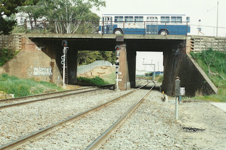 |
| In 1995, a Fearnes Wagga bus crosses the bridge. This is the view looking west, towards Albury |
The bridge is on the western end of Wagga's station. Earlier this week, whilst waiting for my car to be serviced, I thought I would take a few more photos, of this soon to be replaced bridge.
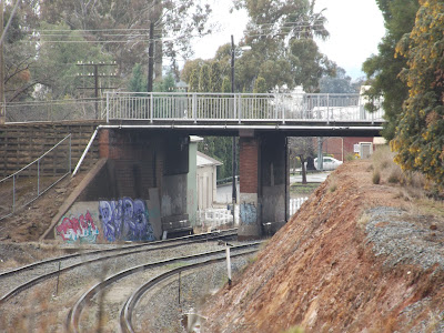 |
| Western side of the bridge, as viewed from the Cassidy Footbridge, in 2016. Close look at the central pier shows an interesting feature |
 |
| Another picture from 2016. The security fence prevents access to the line. |
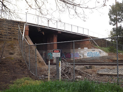
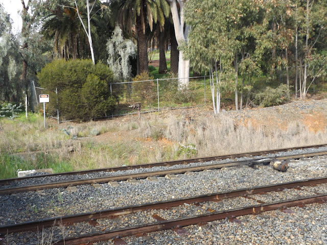
 |
| The fence also makes picture taking awkward. This picture from last monday shows part of the fence, as the camera is raised well above ones head. The central pier shows that it might have been extended |
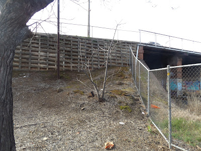 |
| Cribbed retaining wall has built up the roadway |
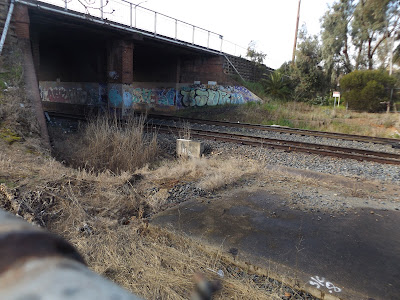
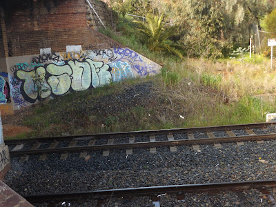 |
| Some of the graffitti from 2016, is still present in 2022. Note the different coloured brickwork where the wing retaining wall changes from a slope, to vertical. More evidence that the roadway has been widened in the past |
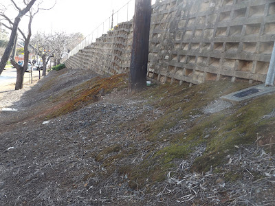 |
| Cribbed retailing wall stretches down the hill towards Edward Street (Sturt Highway). The slope of the roadway is planned to be increased for the new replacement bridge - causing some community concerns. |
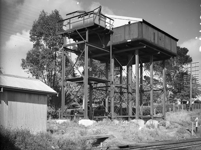 |
| A 1949 picture of a water tank, and alkali plant, located just west of the bridge. I do not know when this was removed. But there is evidence if you look closely. |
 |
| A pair of water pipes can just been seen poking above the grass. The shadow of the bridge railing can be seen on the track. The fence at the back is the boundary to Mount Erin school. |
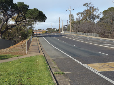 |
| The roadway, as viewed from the Edward Street intersection. |
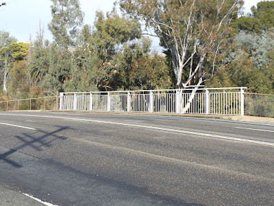 |
| The pedestrian railing is quite simple |
 |
| Lineside poles have the wires going over the road, rather than through the bridge |
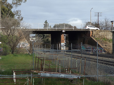 |
| Access to the bridge is much harder in 2022, than even 2016 |
 |
| View from "Mothers Bridge" footbridge - looking west. Note the offcenter pier |
From what I can determine, the bridge was built to replace an earlier level crossing approx 1940. It was originally just a 2 lane bridge, and later widened to 4 lanes with the growth of Wagga Wagga, south of the railway line - and I dimly remember this happening in the 1960s. The construction is typical NSW, with sloping wing walls. The deck is re-inforced concrete, over some shallow steel beams.
I plan to include a model of this bridge on my layout, but won't have the space for a full roadway ramp.
 |
| In 2012, A preserved Southern Aurora passes under the roadbridge on the main line, rather than the platform loop. Picture from the internet |
Inland RailAs mentioned before, the bridge is planned to be replaced. Below is the artist impression of the new bridge, as seen on Inland Rail's website
 |
| The gradient for the footpath from Edward Street is too steep to meet modern regulations, so there is a zig-zag provided on the station side. |
Some bonus pictures (if you have got this far)
A Junee bound Pacific National wheat train approaches Marrar, on the Junee-Narrandera line on August 18th. The canola fields are bright yellow. The road is the Canola Way, and well worth the detour if you are travelling to Adelaide via the Hume/Sturt Hwy
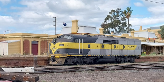 |
| Another classic streamliner at Junee - GM27 last August. Same spot as 4204 last month. This one has been also saved from the scrappers, but has been refurbished/rebuilt for SSR (Southern Shorthaul Railroad) freight train operators |


.jpg)
.jpg)

Interesting background on the bridge Rob. Always enjoy reading your sleuthing stories around Wagga Wagga, thanks for another enjoyable post.
ReplyDeleteThank you Phil. I find history fascinating, and it rarely a dull topic. Always learning something new. Finding those water pipes was only after I had been sent a picture of the Alkali plant a few years back. I hadn't seen the pipes in 2016, and I thought I was observant.
Delete